Wednesday, June 29, 2016

Thursday, March 3, 2016
Wander Report: Raven Rock State Park - Lillington, NC & Aviator Brewery - Fuquay Varina, NC
 |
| Raven Rock State Park |
Just a short trip down Hwy 421 from Greensboro, NC is a wonderful little gem in the North Carolina State Park System. Raven Rock State Park is located in Lillington, NC. We had a group of approximately 30 people ages 2 and up. It was an unusually warm Saturday for February and the parking lot was close to full when we got there around 9:45 AM.
The park is not a far drive from Raleigh, so I can imagine it is a popular destination for day hikers to get away from the city for a little while.
We hiked the Raven Rock Loop Trail which is listed as a 2.6 mile loop. The mileage is accurate and we added the trail down to the fish traps as well. Total mileage ended up at 4 miles.

The hike is a great hike for kids of all ages. The trail is not difficult and in the beginning follows a creek through the forest. About a mile into the hike, you reach the stairs down to Raven Rock on the shore of the Cape Fear River. There, you can explore the area around the 150 foot rock wall and marvel at the beauty of the trees, rocks and river. There had been some significant rain the week leading up to our hike, so the river was very high and muddy. On a normal day there would be more fishing on the river, but conditions were not favorable this day.
Our kids really enjoyed the rock and we spent most of our time around this feature.

Unfortunately, there is some graffiti around Raven Rock, but luckily it is not terribly noticeable until you get up close.
After you climb back up the stairs and head further up the trail, you reach the overlook. A beautiful vista of the Cape Fear River and it's surroundings. This is a good photo opportunity here.
 |
| Raven Rock Overlook |
We added the Fish Traps section on to our hike, but there was really nothing down this trail. The trail leads you back down to the river, and I imagine there is usually fishing going on. Again, I think it was due to the high waters that no one was fishing.
There are some great backcountry camping opportunities in the park and I look forward to returning and getting a chance to experience this.
Route: Raven Rock Loop Trail with Fish Traps Trail added
Distance: 4 miles
Elevation Change: 300 Feet
Difficulty: Easy, some stairs
Date: 2/20/16
 |
| Longleaf Pine in Raven Rock State Park |
We finished our hike in about 2-1/2 hours and headed to Fuquay Varina to try Aviator Brewery.
 |
| Aviator Smokehouse |
Aviator Brewery is located in the mid town section of Fuquay Varina. There is the brewery on one side of the street and across the street they have a smokehouse restaurant. We chose the Smokehouse since we had quite a few children in our group and they were very accommodating to our group of 25.
The food was excellent, but the beer was what we came for. I started off with the Saison de Aviator with Habanero. It was a typical farmhouse style but the habanero was the star of the show. I am partial to heat so I enjoyed this brew, but without the pepper it would have been quite underwhelming.
Next, the Wide Open Red was poured. This was a delicious hoppy red ale that looked as good as it tasted. Color was a brown with hint of red and a good head. The taste of malts, caramel and bitter hops blended nicely with a crisp finish.
Finally, I ended on the Frost Nipper. I really dig winter ales, and this was a nice offering. It was a nice deep red color. There was some spice in the ale, but nutmeg seemed to dominate the taste. It wasn't my favorite winter ale, but I enjoyed it nonetheless.
Saturday, January 23, 2016
My Alternative Education - The Gore Mountain Range Part 2 "Livin' on a Prayer"
 |
| The Gore Range |
Let's meet the other gentlemen on this patrol that were meandering through the Gore Range with me. This was my "core" Patrol that would always be our kind of "home" group.
Bill, our lead proctor was from Long Island. He was a big burly man with dirty blond hair and beard. Talking with him you could tell he was genuine, a lover of the outdoors, maybe had a little bit of hippie in him, and totally trustworthy. His favorite word was "bomber". Everything had to be "bomber", meaning stable or secure or infalliable.
His counterpart was Mike from Chicago. Mike was a metal head that loved Slayer and came off, at first encounter, a little more intense and sometimes rude. I didn't like Mike at first, but I totally appreciated him after a few days and respected his knowledge of the outdoors and mountain fitness. By the end of the trip, he was one of the most memorable guys I had met.
My fellow students were Steve from Milwaukee, a long haired and skinny as a rail hipster. Steve carried a hackey sack everywhere he went and was about as laid back as you can get.
Eduardo was from Guatemala. He was the guy with possibly the most experience in outdoor life that was not a proctor on our trip. He could be kind of come across as an arrogant dude, but he was quite trustworthy and not above teaching or helping in any way. I liked Eduardo and respected him.
Lance was the local boy. He grew up and lived in Denver. Lance was a tall trim red-headed dude with goatee and looked just like Layne Staley, lead singer of Alice in Chains.
Chris was from Libertyville, IL. A kind of quiet dude at first, but had an infectious laugh. I always kind of wondered to myself if his family was mafia. I don't know why.
Jay was from Boise, Idaho. He was some kind of professional snowboarder or something and I could tell he came from a pretty "well-off" family. He had all of the newest and most expensive gear it seemed. Jay was a good kid though and fit right in.
Tony was from up-state NY somewhere. Tony was another tall and lanky guy. Long brown hair and thick NY accent.
Lastly, there was Mike. Mike was from Bellmont, WA and was the quietest guy I have ever met. I can't remember his exact age, but he was young. Physically, he was probably the most fit of all of us, endurance-wise anyhow.
Day 4, I had woken up thinking to myself this will be the hardest thing I will ever do in my life. My legs were killing me but I was in a great state of mind and ready for the challenge of this experience. I could have been a little sleep deprived as well. The mountain goats were taking a lot more time for me to get used to and they kept me up many times throughout the night.
The next two days' agenda included rock climbing and a peak climb. My journal entry from day 4 said it all, "My legs are killing me but somehow I just keep moving". The upside was that we would be staying in one base camp for the next 2 nights.
I had certainly rock climbed at indoor gyms, but not out in the wild on "real" rocks. I did better than I expected to do. Out of the 3 climbs we did, I made it through 2 completely. That third one showed me how far my fitness level needed to be raised, but I wasn't scared. I embraced that challenge. Important side note: when I began this experience I weighed in at about 235 lbs, was a smoker, drank more beer than I should, and had a non-existent fitness routine.
That afternoon, we learned wilderness first aid and hooking a fall line in preparation for our peak climb the next day. I also decided on this day to set a goal of doing 200 push ups a day. My strategy was to split up the day and do 10-20 push-ups at different times throughout the day. 10 when I woke up, 10 after breakfast, 10 at the first water break of the day, etc. Pretty much whenever we stopped for a long enough time to take the pack off.
We woke up the next morning at 5:00 AM and began our peak journey at 6:15, reaching the peak at 9:10. It was an incredible view at the top. Vail was visible in the distance and I could hear the wind fighting through the mountains. All of the lakes were glistening in the sun. Snow caps that have been on this mountain for thousands of years from left over glaciers were scattered sporadically across the mountain.
 |
| Bagging my first peak in the Gore Range |
Our first re-supply was the next day, and I remember being excited that we were going to get to sleep in until 7:00 AM before hiking into re-supply. "Sleeping in" until 7:00 AM would have been a complete joke in my normal life. Heck, many mornings I was "going to bed" at 7:00 AM.
Re-supply was incredible. I never thought I would be that excited to have bacon, oranges, milk or bagels. We hung out at re-supply for about 4 hours. Josh, our LC (Logistics Coordinator) was my one connection to the outside news and thanks to him, I found out that Mark McGuire had just hit #62 that summer. For those that don't remember, Mark McGuire was chasing the MLB home run record that summer.
Bill and Mike set out ahead of us from re-supply to find our next camp. As we set out, the rain started and we started moving fast. We had a brief lunch and as we were reviewing the map, we realized we had hiked right by the pass we were supposed to take.
After about 20 minutes of hiking back the way we had just come, a pretty intense looking thunderstorm was threatening. We decided as a group that the pass was not where we wanted to be in a lightening situation, so we decided to set up camp in the valley and wait it out til morning.
Under the tarps, we huddled together as hail pelted the campsite for about an hour. I was freezing. Wearing shorts and wet socks, I just decided to climb in my sleeping bag and go to bed.
Luckily, the next morning our delegated scouts, Steve, Jay and Eduardo hiked over the pass and found Mike and Bill. While we are waiting on them to all return back to our camp, Tony has managed to throw his back out or something and Lance is having stomach issues and is worried he has Giardia.
When Mike and Bill get back to our camp, they make the decision to hike back to the re-supply area. Bill, miraculously finds a doctor that is actually on the OB Board of Directors and they evacuate Lance and Tony to join Chris who was already out of commission previously (but I cannot recall why).
We hike double time that day and make it back to camp where we were supposed to be the day before. We hiked past Upper Piney Lake and climbed the steep Grass Pass. We actually had to do some rock scrambling with full packs near the top of Grass Pass. From there we traversed over to Melodrama Pass where we were forced to lower our packs down with ropes before climbing down.
 |
| Upper Piney Lake |
I was getting ready to begin my outdoor Jedi training....
Wednesday, January 13, 2016
Wander Report: Crowder's Trail - Crowders Mountain State Park, NC
 |
| One of the many boulders on Crowder's Trail. |
Distance: 6 miles total (out and back)
Elevation change: 686 ft.
Difficulty: Moderate (mainly due to the distance of the hike)
Date: 1/9/2016
Crowders Mountain State Park is located just south of Charlotte in Gaston County. This was our first trip to this state park. The weather was overcast with a dense fog. Temperatures were around 50 degrees.
The area had received quite a bit of rainfall in the week leading up to our hike, so we were a little worried about the trail conditions. Thankfully, there was not an issue with mud and/or slippery conditions on the trails we navigated.
The hike began at the park office and begins with a small drop in elevation for the first quarter mile. The climb up Crowder's Trail is a rolling climb that is very subtle. There are a couple of foot bridges over small creeks in the first mile and we met some volunteers in this first mile that were doing trail maintenance on a connecting trail. Crowder's trail does cross a state road around the one mile mark.
 |
| Volunteers on Crowder's Trail |
At the end of Crowder's Trail, we met up with the Backside trail to the summit of the mountain. This was a short .4 mile hike up a gravel trail and ultimately 316 +/- wooden railroad tie steps. Along the gravel portion you can view the rock faces that many rock climbers tackle. With the wet conditions, we did not witness any rock climbing. This .4 mile section is the hardest part of the climb as you will gain about 420 feet on this portion alone.
 |
| stairs on Backside Trail |
 |
| A foggy summit at Crowders Mountain |
The trail is a popular trail for hikers and runners. Since the weather was a little daunting, I can only imagine how crowded this trail could be on a clear day. We were hiking on a Saturday and we started around 10:30 AM.
 |
| Skittles' favorite tree on the hike |
 |
| Our group of kids at the summit with Buddy Bison |
Wednesday, January 6, 2016
My Alternative Education - The Gore Mountain Range Part 1
 |
| The birth of Wandering Rust |
I got off the plane in Denver on a hot sunny afternoon in the late summer of 1998. This was my first trip into the western United States. I was alone and completely naive to the journey I was about to embark on. The shuttle picked me and my newly purchased gear up and took me to my home for my last night in society for at least the next 28 days.
I was off to the Colorado Outward Bound School for a semester jaunt across the Western United States.
The semester course consisted of a month trekking across the Gore Mountain Range, two and a half weeks of paddling the Green/Colorado River through Cataract Canyon, 30 days of rock climbing in Joshua Tree and lastly, navigating the canyons of Southeast Utah.
The shuttle picked me up along with 40+ other strangers that mostly looked as nervous and naive as I felt. There was one particular person though that caught my attention immediately. A tall slender young man obviously from South Asian decent climbed onto the motor coach wearing a tweed jacket and carrying a suitcase. He looked more like a tourist heading to the nearest resort rather than hitting the trail for the next 96 days.
His name was Raj and as fate would have it, he was from North Carolina (kind of) just like me. He grew up in Hickory, NC but was now living in New Jersey. Turns out that his father had signed him up for this adventure and told him he would be staying in a cabin in the woods and hiking around the area during the day. Wow! Not sure if his Dad just didn't know what this was or if he sugarcoated the itinerary to insure Raj would still go. Either way, I found this hilarious. Luckily, Raj did too.
As the motor coach pulled into the Colorado Outward Bound School (COBS) base camp in Leadville, CO we poured out of the doors and were greeted by the staff/proctors that would be our guides and teachers in the mountains. "Take your bags up the hill and change into your tennis shoes" said the director.
The next thing I know, we are all hiking in a line through the surrounding woods. We moved in and out of the pine needle bed forest and finally we were lead directly into a small pond and came to a dead stop in the middle of the pond. You heard me correctly. There I was, jaunting through water about knee deep or so when the thought hit me "what the hell have you signed up for here?" As we stood there in the water, the proctors went into a 10 minute or so speech about what was ahead of us the next three months.
After this brief adventure around base camp, we were split into our small patrols that would be our families for the next 30 days or so. The total semester class was about 70 people. My patrol was made up of 8 guys ranging in age from 18 to 23 (my age).
First on the agenda, unpack our bags and layout everything you think you will need for the next 28 days. I, of course, knew in the back of mind that this was some sort of trick question, but I quickly learned that I was getting ready to get way out of my comfort zone. This is what I ultimately was left with for personal belongings for the next month:
- 1 backpack
- 1 sleeping bag
- a tarp with some paracord
- my Asolo hiking boots
- 1 pair of tennis shoes (camp shoes)
- 2 pairs of wool socks
- 1 long sleeved polypropylene shirt
- 1 wool sweater
- 1 pair of shorts
- 1 pair of fleece pants
- 1 fleece jacket
- 1 fleece vest
- 1 fleece hat
- 1 pair of gaiters
- 1 pair of rain pants
- 1 rain jacket
- sunglasses
- camera
- journal and pen
- toothbrush/toothpaste
- plus some group items I would be in charge of carrying (food, pots or pans, MSR stove, shovel, etc.)
No tent. No tee shirts. No jeans. No underwear. No toilet paper. No deodorant. No books. No Walkman (for the younger generation go ask your parents). What felt like the end of the world, was quite appreciated after only 3 days on the trail. We spent the first night in base camp and set out separately in our patrols the next day into the Gore Mountain Range
 |
| photo courtesy of Examiner.com |
.
Day 1 was a short six mile hike to our first camp site. My pack weighed about 45 lbs. and yes, this was my first time carrying anything remotely close to this amount of weight in a backpack. We had enough food between the 8 of us to last one week (when we would be re-supplied). When we reached camp that afternoon, I was proud of my efforts. My high school cross country self had re-emerged, so I thought. I was indestructible.
Growing up in North Carolina I was accustomed to some hiking (day hiking) in the Smokey Mountains and Blue Ridge Mountains. There were difficult hikes back home, but it was different. There were many more balds in the Colorado mountains. The rocky top mountains in Colorado were a stark contrast to the tree covered mountains I had been in back home. The trees and rhododendron offered a somewhat safe feeling from the mountain elements. Here in the Gore Range I felt exposed and vulnerable.
The scenery was overwhelming at first. I had never seen anything like it. To try and take a picture, I didn't even know where to start. I just let it all soak in the best I could.
Growing up in North Carolina I was accustomed to some hiking (day hiking) in the Smokey Mountains and Blue Ridge Mountains. There were difficult hikes back home, but it was different. There were many more balds in the Colorado mountains. The rocky top mountains in Colorado were a stark contrast to the tree covered mountains I had been in back home. The trees and rhododendron offered a somewhat safe feeling from the mountain elements. Here in the Gore Range I felt exposed and vulnerable.
The scenery was overwhelming at first. I had never seen anything like it. To try and take a picture, I didn't even know where to start. I just let it all soak in the best I could.
As with all Outward Bound programs, we practiced Leave No Trace ethics. We wanted to leave the very least impact on the environment that we could possibly do. This meant no fire. I had been envisioning sitting around a campfire every evening for the last 3 months. For some reason I was more okay with this than I thought I would be.
The weather was pleasant and I decided no need for a tarp tonight. I slept under the stars cowboy style, which was a great decision I might add. As I was lying there looking up at the night sky, I felt at peace and genuinely excited about being in nature with just my boots and my backpack. It took forever to fall asleep that night. I was still not used to going to bed when the sun set. This would be the last night in the mountains that I would have any trouble getting to sleep.
Day 2, we woke before the sun was up. We discussed our plan for this day last night while we were introduced to reading the topographical map. A quick review of the plan over breakfast and we started to break camp. Practicing our LNT ethics, we went so far as to go over the camp and brush the ground so the blades of grass would stand back up from where we had been lying or sitting the night before. Crazy, I know, but well worth it for the lesson it taught. I appreciated the environment and the never ending efforts COBS took to instill this in all of their students.
As we hit the trail, I could most certainly feel the day before in my legs and lungs. That high school cross country runner was long gone. A mile in we started to climb a little. My lungs were burning and my calves were already beginning to tighten. My back was aching and I was leaning more and more forward with each step as I was trying to balance the weight of the pack.
I was the oldest in the group (besides the two proctors), but certainly not considered old. I was only 23 years old, but the young guys seemed to be blazing through like it was nothing. 4 miles in and I was officially struggling. "When was lunch" I thought to myself. Do we ever take a break? The past couple of years of smoking and drinking and debauchery of college and the sedentary lifestyle I had fallen into had taken a toll on my body that I had never really appreciated.
Thankfully, we stopped for lunch about 5 miles into our day. As I sat and ate my apple and crackers with canned tuna fish, I really started to feel nervous that I was not cut out for this. I was scared.
Lunch was over after about 30 minutes. Time to put that monster back on my shoulders. I stood up, got my pack on and felt surprisingly good...for about 10 steps. The last 3 miles of the day were going to take us up and over a pass before descending into the next valley for camp.
I was about a fourth of the way up the pass when my calves started cramping. My breathing was getting very heavy. They had warned us about altitude sickness. Is that what I was feeling? My body was absolutely worn slap out. My fellow patrol members started taking some of the weight out of my pack and putting it in theirs to lighten my load. I was devastated. Here I was, the fat boy that was slowing everyone down. I was an iota away from quitting.
My lead proctor, Bill hung back with me. One step, rest. One step, rest. He willed me up that pass. No matter how many times I stopped and needed to rest, he was there to lift me up and tell me to press through. I learned that day it was not about speed necessarily. It was about survival. Just make it up the mountain (or to the next stop) no matter what it takes.
I practically crawled into camp that afternoon. My body was done. My mind was done. I thought for sure I would be heading home early. I got some food in me and drank my iodine-purified water and proceeded to pass out for the next 10 hours.
Day 3 I distinctly remember waking to heavy breathing and chewing. I heard what I thought were cattle or horses. My eyes opened to a herd of mountain goat that had decided our camp area was the place to come eat grass. They did not bother us, they just kind of roamed through like nothing new was going on. The goats were large and obviously very strong. The muscles in their shoulders resembled more of a bull than a goat.
 |
| Mountain goats of Colorado |
With all of the excitement over our new camp guests, I did not even realize that my body did not hurt like it did the day before. Yes, I could feel fatigue, but I was surprisingly spry that morning. I was not afraid of what the day would bring. I was excited. I was experiencing nature and the earth. I was becoming a part of the environment rather than an observer. My mind was opening. I was alive and this was only the beginning. I was re-born.
To be continued...
Saturday, January 2, 2016
Not Every Hike is a Perfect Day - Morrow Mountain State Park

Let's get this year off on the right foot (and left). We awoke this morning to Skittles and the Doobs greeting us at the bed. "Are we going hiking today?" they said. This is the best feeling in the world, to have my two children as excited about getting on the trails as my wife and I are. Of course, it is the first day in about a week and a half that we have had a full day with no rain and it has been longer than we have gone all year since our last hike.
We had been planning this hike all week in preparation of the new year. Our State Parks System is celebrating it's centennial anniversary this year and many parks hosted First Day hikes this weekend in our state.
The family headed south to Morrow Mountain State Park. It is nestled near the Uwharrie National Forest area and is neighbored by the PeeDee River basin. It is about an hour and twenty minute drive from the Greensboro area. The family decided on the Morrow Mountain trail for our adventure.
As with many families consisting of children under 6, we had some delays and got to the park about 2:00 PM. We decided to start from the top of the mountain and use the Mountain Loop Trail as somewhat of a warm up to our hike. The Mountain Loop trail is about .6 miles and is a loop around the summit of the mountain. The views are amazing, but beware the trail is quite narrow and has a loose rock trail in many areas. I was on edge, literally, every time my 4 year old would try and jog to catch up with her sister and mother. The drop off is very steep in sections but the views are awesome.
 |
| Dad, Skittles and the Doobs on the Mountain Loop trail in Morrow Mountain State Park. |
Then, we connected to the Morrow Mountain Trail and began the descent. The trail is listed as a 2.6 mile one way hike on the State Park site, but beware, some of the popular apps are incorrect in describing this trail as a loop. Near the top of the mountain, the beginning of our hike, it is quite steep and the trail does not flow in switchbacks. It is straight vertical and can be slippery in places. About half way down the descent, my kids were already telling me they were tired.
So, here we were in a predicament. Not only were we fighting tired legs on the kids, daylight was now a factor. Knowing that we were going to be carrying our two young ones back up the hill, my wife and I begrudgingly decided to turn around and head back about a mile into the trail. So, our day was cut shorter than we had planned and hoped, but we were all excited to be back outside and on the trail even for a brief amount of time.
I cannot give an official review of this trail knowing that we did not complete it, but what I can tell you is that this trail is no joke for young children. I also would recommend starting low at the Museum on the Sugar Loaf trail and connecting to the Morrow Mountain trail and climb. Starting from the top is not the most exciting route in my opinion, but I am a big fan of getting rewarded with the view at the top after climbing (not at the start if the climb).
So, we will consider this our warm up for our hiking club outing next weekend. The park looks amazing and we will be back later in the spring to give it a little more attention.

Wednesday, September 2, 2015
Dad, Skittles, Cheerio Nation and the Mountain - A Weekend to Remember
 |
| Searching for salamanders at Cheerio |
Skittles (my oldest daughter) and I hit the road this past weekend for our bi-annual Father/Daughter weekend in the Mountains. We are fortunate to be a part of the YMCA Indian Guides/Indian Princesses program. The entire program is centered around the motive of kids having quality time with their father away from the daily routines we have at home.
We head up the mountain to Roaring Gap, the home of Camp Cheerio. I set up the tent that we will call home for the next two nights while she gets dragged away by her friends for some free play in the woods.

We are all part of Cheerio Nation and separated into tribes. So, our tribe, Comanche, has about 20-25 Dads with their daughter(s) ages 5 to 14. The majority of the time is spent one on one with our daughters, but we do eat meals as a group and we have a big "Fire and Water" ceremony Saturday night for all of the tribes together.
There are some really special memories made over this weekend. Through my experiences, I observed some things that really stuck out to me. They are not specific to my weekend and can be applied to any father/daughter or mother/daughter scenario. So, I thought I would share some of those important ones that really enhanced my experience with my daughter.
- Let her lead. We did everything she wanted to do. We went canoeing, we hiked, we fed the horses (she did not want to ride them), we hit he waterslide into the lake and we walked through the creek searching out salamanders and crawfish. Man that water was cold! I was completely at her command and it was awesome.

- Let her explore. This was the hardest thing for me to do at first, but during the time we were together as a group I let her go with her friends to free play. At Camp Cheerio, it is a somewhat controlled setting that allows kids to roam to a certain degree. We don't really have these types of settings on hand at home. I let her follow her friends and older kids as a group while they explored the woods, played ball games and had talent shows. I wish I could bottle the laughter and energy that this group possessed.
- Listen to her. This was one of those unique times where cell phones, TV and computers are not present. Conversation is at a premium. Take advantage. Skittles, being in the youngest age group was asleep in the tent earlier than most of the older kids and I made it a point to hang around the tent while she is sleeping. I noticed my tent neighbor hanging out at his tent as well. He had his 3 daughters with him and they were all just hanging out. The strength of their relationship was radiating from them. He really listened to them and in turn, they listened to him.

- Talk to her. I really made sure to tell her every chance I could why we were there. "I love you and I want to spend time with you". This will never change and I know that she will grow to appreciate these times we have together (maybe not so much during the teenage years, but a Dad can hope).
Next year, my youngest daughter, The Doobs, will be old enough to join us in the program. I cannot wait to share this experience with her as well.

A little about Camp Cheerio...
Camp Cheerio offers summer residential camping for children ages 7-15. During the five weeks of girls camp or the five weeks of co-ed camp, Cheerio offers campers the chance to participate in over 35 different activities that help them explore and develop their potential and their lives as young Christians in an environment that is safe and supportive.
For the more adventurous spirits, Cheerio Adventures offers a more extreme outdoor experience.
I was a Cheerio camper in the early 80's and all of my siblings as well. I am fortunate to sit on the Cheerio Board of Advisors as an adult.
Wednesday, August 26, 2015
Obstacles Our Children Face with Our National Parks?
 |
| Half Dome in Yosemite National Park |
There has been a lot of talk lately in many of my circles about engaging the Millennial generation in our National Parks. Is it too late to reach this generation? This generation certainly has it's share of obstacles. From technology addiction to limited jobs and income, it all factors into the equation of this problem. Here are 5 issues I see as relevant to the success of National Parks in future generations.
1. Time
I suggest that the problem is derived much earlier in childhood. Parents in general do not make getting outside a big enough priority in life. Many times, it is because they can't. Let's face it, vacation travel is a large endeavor for most families in America and time is a precious commodity for the majority of households. Society has changed dramatically with the advancement of technology. We can work from anywhere in many jobs thanks to cell phones, wifi, laptops and tablets, etc.
This adds to many parent's struggle with work life balance in today's society. Prioritizing nature and the outdoors is hard to do for parents when you are constantly worried if you are near wifi or if you can check email. What kind of example does this show our kids?

Unfortunately, I have to add that many kids are splitting weekend time between two families due to divorce as well. It has had a snowball effect on the youth and I fear the perfect storm has rolled in on the Millennial generation.
2. Education
Recently, I was distraught to learn that many of the Recreation, Parks & Tourism programs in the University of North Carolina system were being phased out. The reasons are many, but less interest in the field must be a key factor in this. Where does this passion for learning more about our parks and wild areas come from?
It is one thing to extend a program like Every Kid to a Park, but how do we educate the public on this program and others and get these kids and their parents to actually visit the parks?
3. Accessibility
We live in an "on demand" world. Accessibility in the digital world of internet, texting and social media has spoiled us. We expect information to be brought to us with as little effort on our part as necessary. So, how do we bring the National Parks to the community in a tangible and relevant way to engage further desire to learn?
I would love to see better partnerships between National Parks, State Parks and Municipal Parks. I feel this is one avenue that is grossly under utilized considering the majority of our population has immediate access to some State or Municipal park. Maybe a local park could host a National Park Day with Rangers present. It has to start somewhere, right?
 |
| Getting to know the ranger at Hanging Rock State Park |
Luckily, we have the 100 year anniversary of our National Parks in 2016 to drum up publicity. The National Park Foundation has done a decent job with the #findyourpark campaign. But, what happens after that?
There is a great show broadcast on the CW on Saturday mornings called Rock the Park. Jack and Colton are visiting every National Park and are sharing their experiences on this program. It is a fantastic program for kids and adults to learn more about our National Parks System. How do we expand upon this?
5. Money
Let's face it. All of the problems listed above boil down to the same factor, not enough money. More exposure and more involvement can lead to more people getting involved monetarily with our parks. More involvement makes our voice a little louder to government when deciding on spending for our National Park System.
We can always contribute on our own through charities like the National Park Foundation, but many feel (and they are correct) they already contribute every year on April 15th when they pay their taxes.
Money is going to be a driving influence on any program or initiative that is put into action. The key is to initiate involvement and interest in our National Parks. I have heard this more than once, but it is so true..."Just get them to the park and let nature take over".
Monday, August 24, 2015
Wander Report: Piedmont Trail - Bur Mil Park, Greensboro, NC
 |
| Lake Brandt from the Piedmont Trail |
It is the last weekend before school officially starts. Skittles is starting Kindergarten and The Doobs is in the 3 year old pre-K class. Friday, we asked "what do you want to do this weekend for your last summer hoo-rah." Both, to Mommy and Daddy's delight, said they wanted to go hiking on Saturday. We had gotten both of them new hiking shoes and they were dying to try them out.
We needed to stay fairly close to home due to a dinner engagement, so we headed over to Bur Mil Park in Greensboro, NC for a hike at Lake Brandt on the Piedmont Trail.
 |
| The trailhead for the Piedmont Trail |
The trailhead was easy enough to find. We parked on Strawberry Road where the Greenway crosses, just off of 220 (Battleground Ave.) . The Piedmont Trail begins just up the Greenway about .10 miles.
 |
| Heading off into the Kudzu |
Just before heading into the trees, there is a great view of the lake. But, once we entered the woods nature took over and gave the kids a show they had not seen before on any of our previous hikes.
We were very fortunate to see quite a bit of wildlife on the trail this day. First, the ducks startled us as we walked close to the water to get a good view of the lake. A heron glided by us as it hovered inches above the water. We met a frog just off the side of the trail.
About a mile into the hike, we made our way around a bend to see a young deer standing right in the middle of the trail. To see the girls' faces was priceless as the deer just stood there and watched us in between bites of grass. As we crept softly closer, the deer just took a few leaps to get out of the way, but stayed close enough to see. Then when we thought we were clear of her, we look to the left and there was another young deer not 20 feet away from us.
The trail is accented by some great wooden bridges and footpaths through some of the wetlands. It is a very flat hike and was fairly quiet for a Saturday. Just a few trail runners and hikers.
 |
| Wander Woman, The Doobs and Skittles |
We were pleasantly surprised at the amount of distance The Doobs covered on her own two feet. She made it almost 3 miles on her own (way further than her 3 year old legs had ever carried her previously). Skittles (our 5 year old) championed the trail for over 4 miles and only needed to be carried for a brief stretch.
To be so close to home, we could not have imagined a better hiking day.
Wandering Notes:
Distance: 5.75 Miles
Elevation Gain: 67 Feet
Difficulty: This is an easy hike in regards to elevation, but I say moderate due to the length of the hike for kids. It is a flat, out and back hike that hugs the coast of Lake Brandt for the majority of the trek. Lots of roots in areas, but well blazed trail. Trail is hiking/running only - no bikes!
Tuesday, August 18, 2015
Wander Report: Eno River State Park - Durham, NC
 |
| A great hike for kids - Cox Mountain Trail |
Just off Interstate 85 in Durham, NC, a hidden gem called Eno River State Park hides in the thick forest. Since my family had never been there, we did not know what to expect when we arrived to the park on Saturday, August 8th. Of course, we had done some on-line research of the park to plan our hike for the day and the good reviews that the park received on the websites were well deserved. We were set to hike the Cox Mountain Trail.
The weather when we met up Saturday morning was a little overcast and for August, cool at about 77 degrees. We were to meet at the Eno River Park office. Let me tell you, if you have a large group meeting - do not meet at the park office. Parking is not plentiful at the office. We had 34 total people (13 kids 8 and under) participate in our August club hike.

The trail head for the Cox Mountain Trail is located at the very end of the park's main road that feeds into a circular parking lot. There is plenty of parking down here and clearly marked signs showing the trails. For all of us parents, it is also important to note that there are full service restrooms here at the trail head as well.
 |
| Crossing the suspension bridge |
The trail begins with a stroll through the park picnic shelter area and quickly turns toward the river. The trail is marked by blue trail blazes. About a quarter of a mile into the hike, you reach the river and one of the coolest features of the hike is right here. A 50 foot suspension bridge crosses the Eno and below is a great area to let the kids get their feet wet in the river. We brought water shoes and change of clothes for the kids just in case we got a little too wet.
After crossing the river, the trail's only real climb awaits you. It is a rocky terrain with wooden railroad tie steps to help navigate the inclines. The trail is surrounded by hardwood forest here. Close to a mile and a half in to the trail you come back to the river and hike along side the river for about half a mile. It is a great place to view and listen to local wildlife. We were lucky to see turtles, butterflies, toads, Cherry millipedes, Stag beetles and a Northern Ring Neck snake. Thank goodness our resident expert Sam (8 years old) was there to identify every insect we came across.
The hike is a loop that circles back and let's you cross back over the suspension bridge to get back to the trail head and parking lot.

Wandering Notes:
Distance = 3.7 miles loop
Elevation Gain = 350-400 feet elevation gain
Difficulty = It is a great choice for hiking with kids. It is not too difficult terrain to traverse and there is plenty to keep their attention. It took us around 2.5 hours to complete the hike with a break in the middle for snacks and a couple of play/explore breaks around the river.
We paired our hike with a trip to FULLSTEAM Brewery in Durham, NC. A family-friendly, dog-friendly tavern that has a wonderful selection of craft brews and an arcade to make any 40-ish year old jealous. The adults had a little tasting party while the kids played board games and pinball.

My personal favorite was the Summer Basil, a Farmhouse ale that was quite refreshing and had a unique blend of flavor. I normally lean towards the extreme hoppiness of the IPA's, but the Summer Basil had a good controlled hops flavor. Honorable mentions were Carver, a sweet potato lager and the Rocket Science IPA.


Monday, July 27, 2015
Wander Report: Day Summit of Mount Rogers, VA 7/26/15

It was time to make a second attempt at the summit of the tallest point of the state of Virginia. Just this past spring, we made plans to summit Mount Rogers and were met with 30 degree weather and 50 mph winds. We may have been able to tough it out that day if we did not have our 3 and 4 year old with us, but we were not necessarily prepared for the weather completely. Needless to say, we abandoned any thoughts of bagging this peak in those weather conditions.
Fast forward to July 26th. It was a hike date with my wife, Wander Woman that we were both looking forward to. No kids this time, so we could really up the mileage that we normally do as a family. We reached Grayson Highlands State Park at 10:00 AM to a very comfortable 72 degrees. The morning fog had just lifted to expose partly cloudy skies and there was a nice cool breeze blowing through the park.
We started from the parking area at Massie Gap, where we basically crossed the field to join the trail head for Rhododendron Trail. We passed through the gate and headed up the .8 mile trail. Almost immediately, we found ourselves surrounded by large blueberry bushes and blackberry bushes.
There is a crossroads at the end of this trail that lets you either take a connector trail to the Appalachian Trail (AT) or you can follow the bridal trail. Both lead you to the gate of the park boundary, but we decided to take the bridal trail on our way out. Either way it is only about .25 miles to the gate leading you out of the state park.
Once through the gate, we hiked south on the AT. It is very well marked in this area with white blazes. Quickly, we were navigating through the open balds on the rocky path of the AT. The views are absolutely stunning in this area and as we headed over the first pass we stopped to take in the view and chat with a Virginia Tech student that was up to film the wild ponies.
Unfortunately for him, if he had only hiked .25 - .5 miles further he would have met one of the herds of wild ponies that roam these balds. A mother and what appeared to be her colt were meandering along the trail, heads down, grazing on the grasses of the mountain. The mother actually looked pregnant to us, but I could not confirm this. Soon, the rest of the herd appeared and many more mothers with young ponies in tow. I have to say, it feels very different to hike into a herd of wild animals that are not spooked really when they see you. They didn't seem to mind us coming in close for photos, but I fear it is due to humans feeding them that they have become conditioned to us.
 |
| Pregnant? |
 |
| One of the many young ponies we met on our trek. |
This area of Rhododendron Gap offers more breathtaking views and I highly recommend climbing up the large pinnacle rock to get a panoramic view of the gorgeous landscape.
We followed the white blazes of the AT a while longer through the Crest Zone. A little more than 4 miles into the hike we came to the Thomas Knob Shelter. This was the perfect spot for a lunch break. I highly recommend going behind the shelter out onto the rocks for the best view. This is a pretty big shelter with a second floor that you can reach by ladder. There are also numerous surrounding areas that are obviously carved out by through hikers and over-nighters into perfect campsites. You can see a large grove of blueberry bushes that look to span miles from behind the shelter.

After a quick bite to eat, we continued on the AT for approximately .25 miles and met the Mount Rogers Spur Trail. Here, we left the AT and hiked the .5 miles to the summit of Mount Rogers. It is not a typical peak climb. Here you actually climb into the treeline instead of out of the treeline to a bald summit. It is almost magical when you leave the AT on this trail as you quickly enter a more rainforest-like atmosphere. Deep green hues provided by the moss and ferns on the ground. Numerous mushrooms cover the floor of this forest.
 |
| The false summit with arrow pointing towards the true summit. |
 |
| The true marker of the summit of Mount Rogers. |
The summit does not provide panoramic views of the surrounding valleys and peaks. It is buried deep in the forest and does not resemble a typical peak of a mountain. Much less, the peak of the highest state point of Virginia.
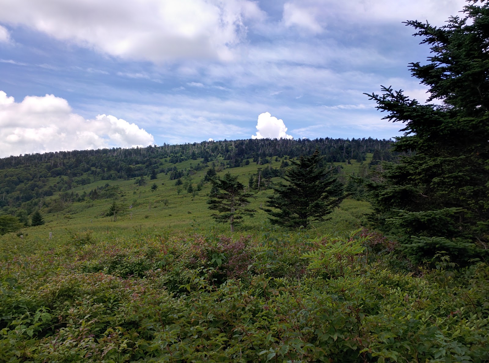 |
| The peak of Mount Rogers from below the treeline. |
Wandering Notes:
Distance = 10 miles according to my GPS tracker
Elevation Change = Around 1100 to 1200 feet
Difficulty = It is actually not a strenuous climb at all. The distance poses the biggest challenge for most. The rocks can be an obstacle for weak ankles, but not difficult to navigate at all. It is a good family hike with lots of great rest stops with beautiful scenery. We averaged a little less than 30 minutes per mile, but really took our time.
Grayson Highlands State Park = A beautiful park with trails, camping, equestrian stables, and a large picnic area that is top notch. Day parking is $4 on weekdays and $5 on weekends and holidays. Grayson Highlands State Park


 |
| Wander Woman |


 |
| Trail register |
 |
| Looking back into Grayson Highlands State Park after crossing out of the park's boundary |
 |
| The bridal trail in Grayson Highlands State Park |
Subscribe to:
Posts (Atom)